
The live map, and everything that happened before.
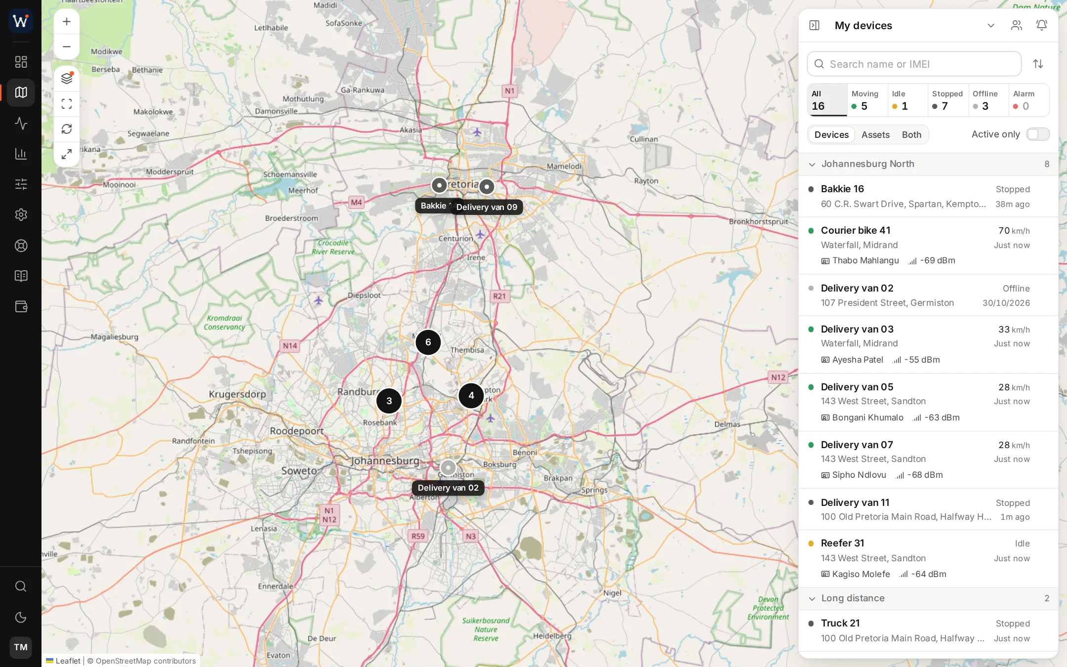
On the live map.
List and map together
Search, filter and group vehicles in the list. On the map they cluster when you zoom out and separate as you zoom in.
The vehicle's card
Clicking a vehicle shows when it last reported, its odometer and fuel, and what the engine is reporting. Switch on follow mode to keep it centred while it moves.
Street View and imagery
Look at the scene around a vehicle in Street View, and switch between road, satellite and hybrid maps.
Extra layers
Turn on overlays for live traffic, camera locations and the speed limit of each road.
Commands
Save the device commands you use and send one, such as immobilise, with a click.
Dashboards
Tiles for utilisation, availability, alerts and safety that each user can arrange, with tabs for safety and speeding.
History, laid out as trips.
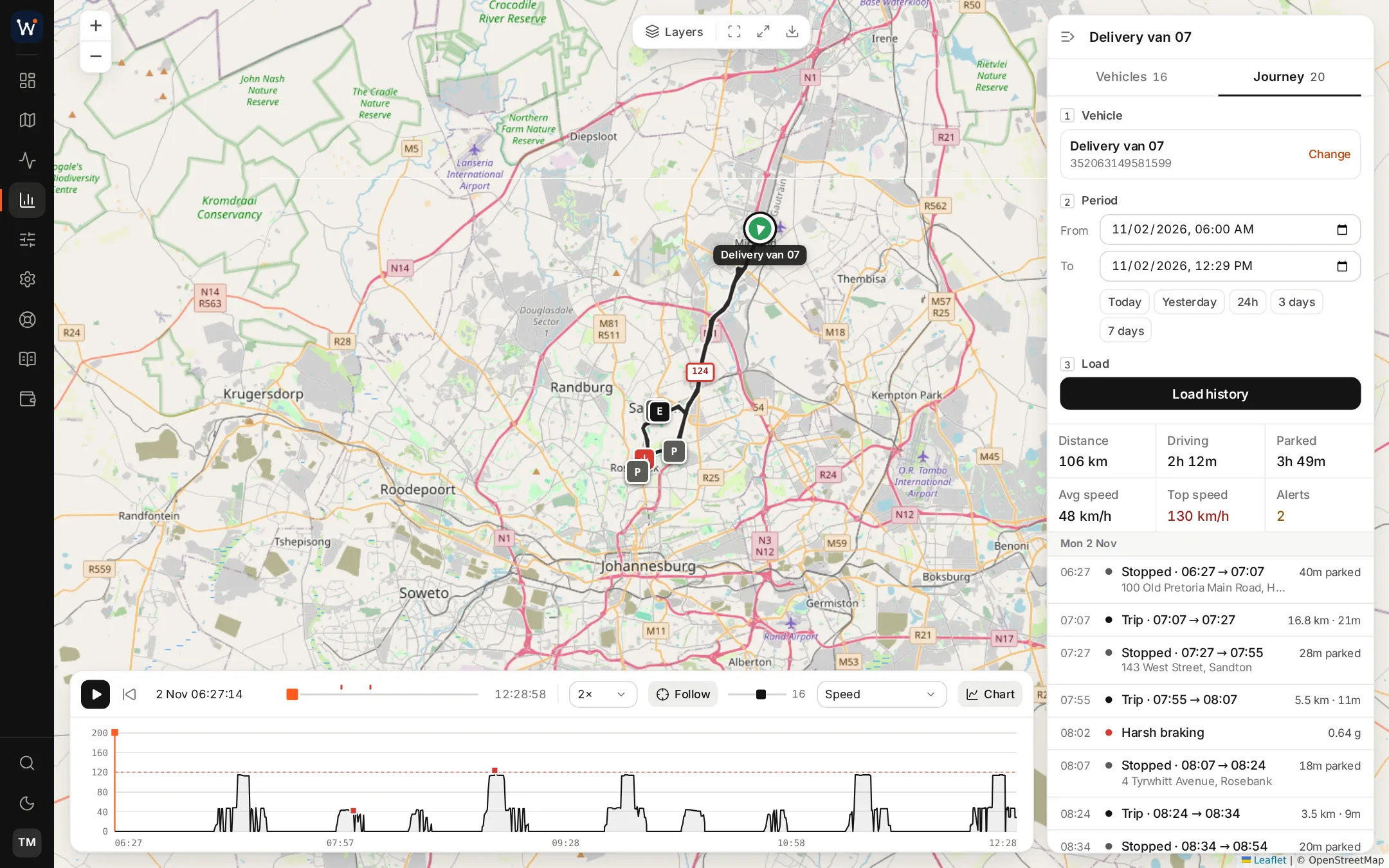
Choose the vehicle and the dates. The route appears broken into individual trips, and a timeline next to the map lists each stop and alert as it happened. Under the map, a speed graph doubles as the playback bar, and you can replay at whatever pace suits.
Each point on the track reveals its timestamp, speed and street address, with Street View and directions one click away. Download the track as CSV, GPX or KML for use in other tools.
- Kilometres covered, hours driving and hours parked
- Harsh driving and speeding pinned to the spot
- Looks and works like the live map
Geofences
Mark out depots, client premises or no-go areas on the map, assign each zone to vehicles or whole groups, and be notified when one is entered or left within the hours you specify.
Shared tracking links
Anyone can follow a vehicle, or several, from a link you send over WhatsApp, by email or by pasting it anywhere. The recipient needs no login and sees nothing else, and every link has an expiry date and can be cancelled sooner.
Related pages
Put your name on a complete tracking service.
Your own server, your branding and the modules you choose, normally handed over within a day of ordering.